High Inland Fire Danger Tuesday Night And Wednesday With Possible Lightning And Wind

The National Weather Service is warning of high fire danger this week with thunderstorms, lightning and wind expected late Tuesday night into Wednesday, July 7. CREDIT: NWS via Twitter

READ ON

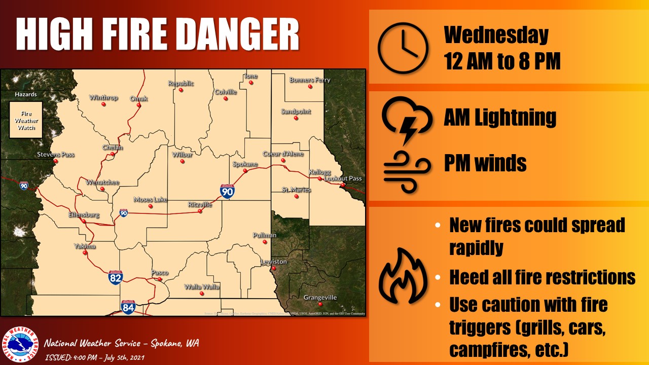
The National Weather Service is warning of extreme fire danger Tuesday night and Wednesday.

Lightning storms, dry conditions and winds are expected to combine Tuesday evening and Wednesday, priming Eastern Washington and North Idaho for wildfires.

Tuesday and Wednesday humidity is expected to be low, and winds are predicted to hover between 10 and 20 miles per hour, with gusts between 25 to 35 miles per an hour.

The National Weather Service is urging community members to follow burn restrictions, most of the state is under a burn ban, and be cautious with things that could start fires, like vehicles or grills.

Copyright 2021 Spokane Public Radio. To see more, visit spokanepublicradio.org

Related Stories:

A map showing large fires that have burned so far this year in Washington. The different colored areas represent different land ownership boundaries. (Courtesy of the Northwest Interagency Coordination Center)

What impacts did wildfires have on the Northwest this summer?

Autumn has knocked on our doors and crossed our thresholds. With its arrival comes wetter, colder, darker days — perhaps some pumpkin-flavored treats as well — and hopefully, fewer wildfires. Heavy recent rainfall has dropped the wildfire potential outlook down to normal for the Northwest, according to the National Significant Wildland Fire Potential Outlook.
So, how did this summer fare compared to past fire seasons?