Listen
(Runtime 1:00)
Read
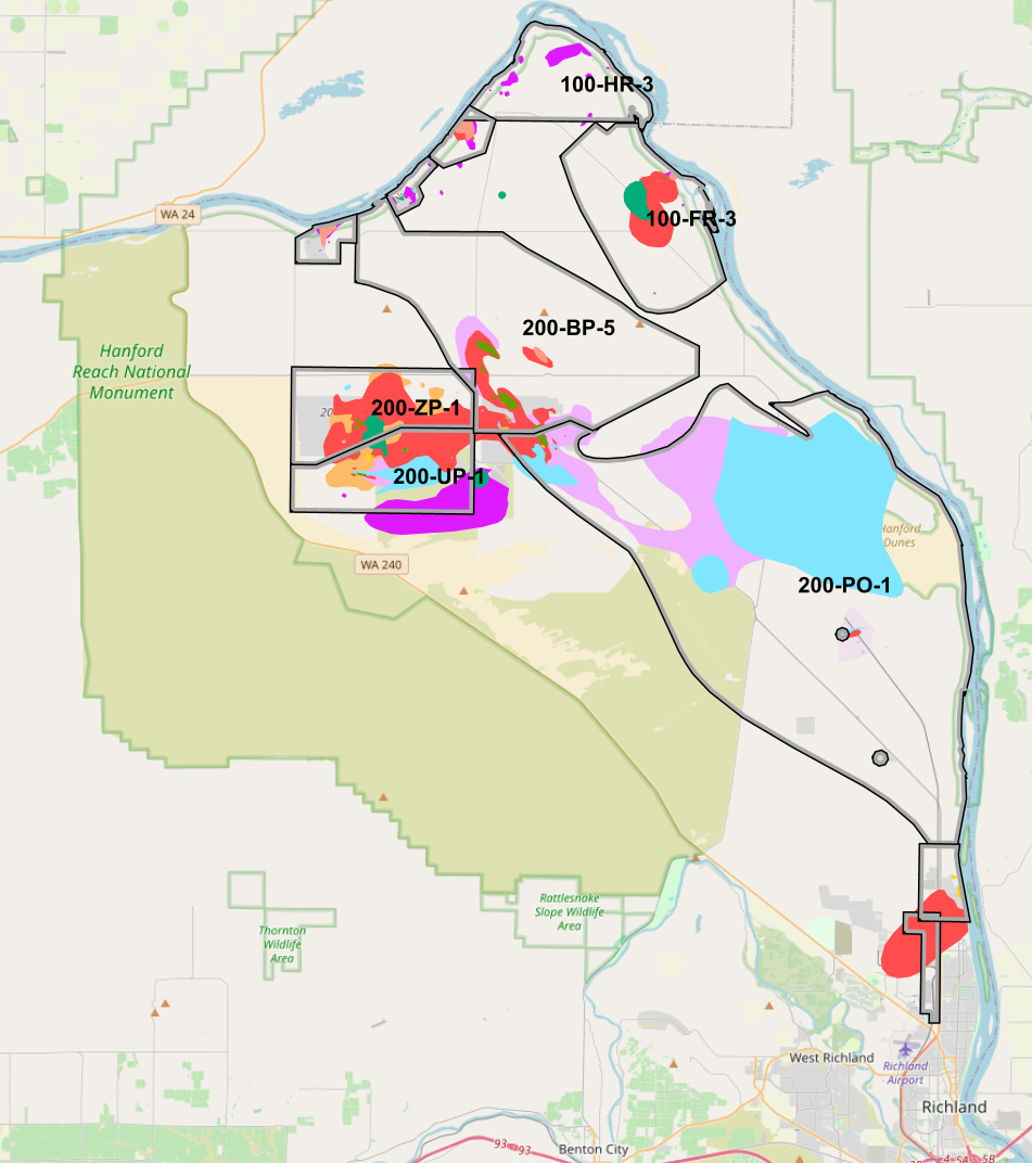
A new online tool is helping people see how contamination is moving through plumes underground at Hanford and other U.S. Department of Energy sites across the country.
At Hanford, millions of gallons of radioactive waste and many chemicals have leaked into the soils from production of plutonium during WWII and the Cold War. Much of it was dumped or injected into the ground in pits, trenches and injection wells, according to the Washington State Department of Ecology.
The new tool is called TRAC, which stands for Tracking Restoration And Closure. It maps the plumes and shows them as animations on a screen for viewers. Near the Columbia River, blobs of color move and expand depending on treatment of the plumes. April Kluever is Acting Director of Subsurface Closure at DOE Headquarters.
“I could imagine somebody who lives along the Columbia River, either as a new resident, new to the area, or they’ve lived there for a while… perhaps they read a newspaper article or they have something that sparks their interest, and they want to know more,” Kluever said. “There’s this site, Hanford. Or I heard about this in (the movie) Oppenhiemer, Hanford. You can go to TRAC and you can learn all of the information.”
Kluever said all of the data is being uploaded across the Energy complex. She said, soon, the data updates of the TRAC program will be done every year across the DOE complex.

The tool shows which technologies are being used, where the contaminated plumes are going and what progress has been made. It will even show the groundwater standard that DOE is trying to meet and the concentration of contamination in the plume.
“We have some of the most complex cleanup scenarios in the world, and we know that,” Kluever said. “We are instituting some of the most cutting-edge technologies to address these most complex scenarios in the world.”
People cleaning up other public or private environmental sites might use the map as a resource, to help understand new technologies available, she said.
She said the three-dimensional setting on the map isn’t available yet, but that DOE is interested in making the map even more useful in the future.
Kluever said DOE hopes to use this same sort of tool to show soil and closed Hanford tanks of radioactive waste that are being cleaned up in the future.
“We started with groundwater because we had a lot of data and it was relatively easy to show in a visual platform like this,” Kluever said.
The TRAC system cost about $750,000 to start up from 2018 through 2023, and costs as much as $50,000 to maintain each year.
TRAC can be accessed at trac.pnnl.gov.