READ ON
Warmer winter weather, more rainfall and less snow will contribute to significantly increased flooding in the Columbia River Basin this century due to climate change, new research says.
New modeling shows an increase of flooding by up to 60% in the next 50 to 100 years, according to a study by Oregon State University’s Oregon Climate Change Research Institute. Less precipitation falling as snow during the winter will lead to earlier spring streamflows for many rivers in the basin, including the Columbia, Willamette and Snake rivers and hundreds of tributaries.
The researchers based their findings on natural river conditions and did not take into consideration the offsetting effects of flood-control infrastructure like dams. Even so, according to the study, the increase is significant. The flooding season will also expand.
“The flood you’re used to seeing out your window once every ten years will likely be larger than it has been in the past,” OSU’s Oregon Climate Change Research Institute lead author and research assistant Laura Queen said.
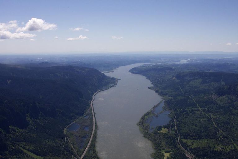
This research was based on better understanding how climate change and warmer weather would impact the Columbia River Basin — which drains much of the Pacific Northwest, neighboring Rocky Mountain states, and parts of British Columbia. It produces the fourth-largest streamflow volume in the United States. The Pacific Northwest also has a history of major flooding in the basin, most recently in eastern Oregon in 2020 andSalem and Eugene in 2019.
Researchers ran simulations using hydrology models and streamflow data for nearly 396 sites throughout the Columbia River basin and other watersheds in Western Washington.
Philip Mote is a co-author of the study, vice provost and graduate school dean at OSU’s College of Earth, Ocean, and Atmospheric Sciences. He said this study was the most comprehensive look to date at how flooding will change in a warmer Northwest.
“We were very surprised that at nearly all of the 400 locations that we simulated, the second part of the century would see higher high flow events, on both the more frequent ones in 10-year events and also the less frequent ones in 100-year events and everything in between,” Mote said.
The research included data from the 1950-1999 and as well as flow data projected for the next 50 to 100 years, developed using different climate models.
Western Oregon’s Willamette River and its tributaries are expected to see the biggest increase in flooding magnitude, with 50% to 60% increases in 100-year floods. The stream flows are expected to be smaller downstream and grow larger upstream.
Willamette Riverkeeper’s Executive Director Travis Williams said this research really makes the case for increasing conversations in climate resilience.
“I think having people clued into the fact that the 100-year flood, as it has been known for a long time or the 500-year flood, is now something that’s going to be more than likely very different and more frequent than what we saw in the past,” he said.
He said we need to be better prepared for floods by improving floodplain habitats along the rivers, especially if research indicates the region will see more rain and less snow in the future.
“Restoring and acquiring floodplain lands and making sure they’re in a healthy condition, planting trees and native shrubs throughout those areas, can help mitigate against the intensity of the flooding that may occur,” Williams said.
The Snake River is another major tributary of the Columbia. It flows from Wyoming into Idaho and along the Idaho-Oregon border until it reaches southeastern Washington and enters the Columbia. The Snake will see a 40% increase in 10-year floods and a 60% increase in 100-year floods, according to the new research
“We don’t know how much of this increased flood risk can be managed through mitigation measures until we study the issue further,” Mote said. “But managing a 30% to 40% increase, as is predicted for many areas, is clearly beyond our management capabilities.”
Mote said further research is underway to better understand the pros and cons of using dams and other measures to control the increasing severity and frequency of floods in the region. He said it’s a complicated process.
“The way reservoirs are managed depends both on the time of year and on the conditions that are happening at the moment,” Mote said.
The findings of the research were published recently in the journal Hydrology and Earth System Science.
Copyright 2021 Oregon Public Broadcasting. To see more, visit opb.org