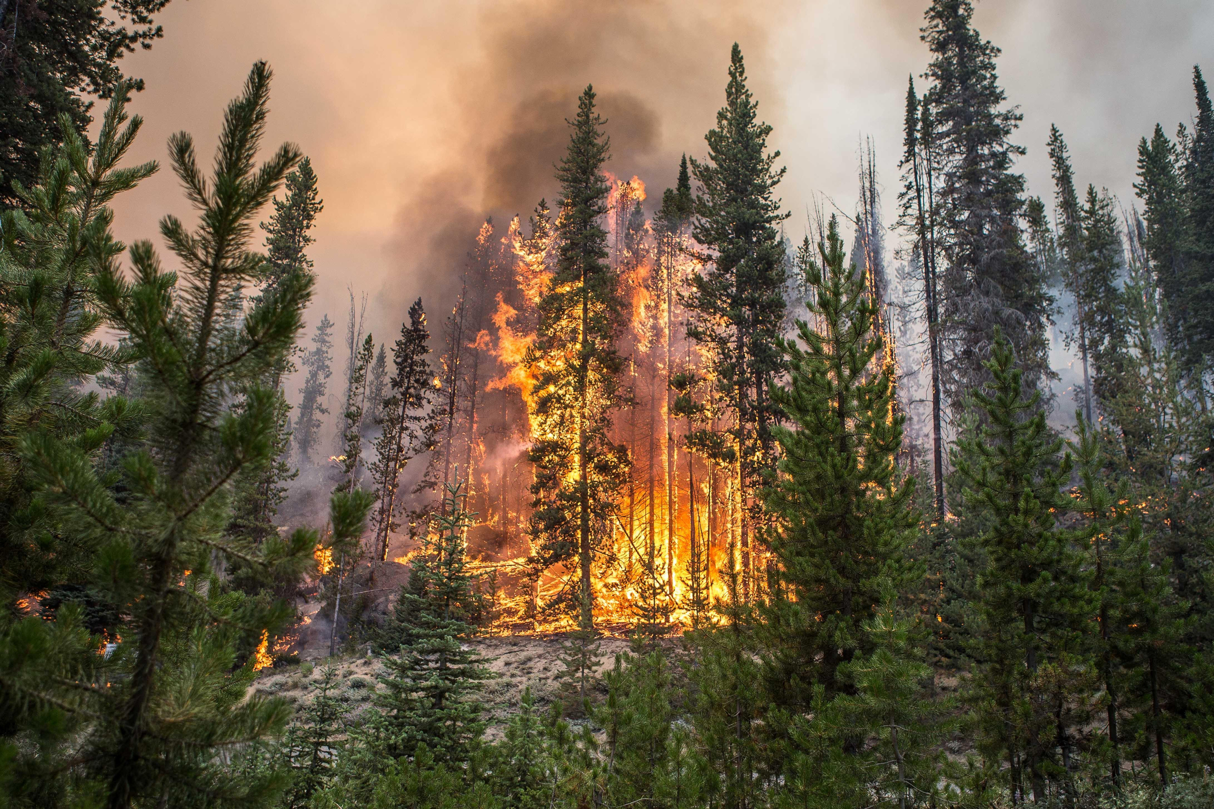
When you open your phone in the morning or check the weather online, you might be seeing an alert lately: "Red Flag (Fire Weather) Warning."
“A Red Flag Warning means if a fire happens today, your firefighters are going to have a hard time controlling it, and you may need to take action,” said Heath Hockenberry, the National Fire Weather Program Manager with the National Weather Service.
The warning means the weather is hot, there is very low humidity and strong winds. Those conditions combined mean an increased risk of fire danger, he said.
Peak fire season in the Northwest stretches from the Fourth of July into early September.
“We had a lot of snowpack, a lot of precipitation, a lot of things that have been keeping the bad fire season at bay,” said Hockenberry. “But of course, we’re getting strings and days of 100 degrees plus, and it doesn’t take long to dry out.”
For decades, the Red Flag Warning was transmitted out on radios. In the age of smartphones and the internet, more people are seeing the warning pop up.

To track weather changes across the Northwest, Remote Automated Weather Stations, or RAWS, have been set up in wildland areas, said Hockenberry. They’re often placed on south-facing slopes that get the most sun and other places prone to extreme weather conditions.
Along with where a fire might happen, it’s important to be aware of wildfire smoke when doing outdoor activities, said Hockenberry.
“We use satellites to find new detections of actual fires that occur from lightning,” said Hockenberry. “We can use radar if the smoke is bad enough. We can actually see smoke plumes and find out how aggressive the fire is and how much smoke it’s putting out.”
Many people think California has the most wildfires of the Western states.
“As far as frequency and return intervals and then the amount of fires: Washington, Oregon, Idaho, Western Montana, southern Canada, are really, really up there,” said Hockenberry.
That’s why the National Interagency Fire Center is located in Boise, Idaho.
“It’s because we are pretty much the fire capital of the nation,” said Hockenberry.
Planning for a fire evacuation
As high temperatures continue, now is the time to have a plan in place in case a fire happens near you. That’s according to Jim Wimer, Fire Information Specialist for the Nez-Perce Clearwater National Forest.
“When these fire events happen, there’s usually area closures, road closures ... and once people leave, they may not be allowed back in until the threats have passed,” said Wimer. “It can become difficult for folks to get back to their residents or their homes after they’ve evacuated.”
Making sure vehicles are gassed up, medications are packed and two weeks of supplies are set aside is a good way to prepare, said Wimer.
People also need to think about their animals. “One thing we end up dealing with a lot after evacuations is pets. Sometimes, they get left,” said Wimer.

For animal companions, make sure their food, water and medication is packed, too. Moving livestock like cattle or sheep can take more logistics and planning, said Wimer.
“Some of that pre-planning is what I would try and get folks to focus on, even before the fire hits, and before that evacuation notice is issued.”
A couple gallons of drinking water, canned or freeze-dried food and a go-bag with essentials like medications and important documents (like passports or birth certificates) should help people feel more prepared in case of an evacuation, he said.
“The store might be closed, the shelves might be empty. Those things really do happen, especially in smaller communities,” said Wimer.
Along with having an evacuation plan in place, AirNow.gov gives people information on smoke and possible health impacts, said Hockenberry.
The Washington Department of Natural Resources, theOregon Department of Forestry and the Idaho Department of Environmental Quality are good resources to find information about wildfires and smoke in the Northwest and to learn if it's safe to camp or be outside.
