Fires In Canada And California Add To Northwest’s Smoky Haze

CREDIT: NATIONAL WEATHER SERVICE

Listen

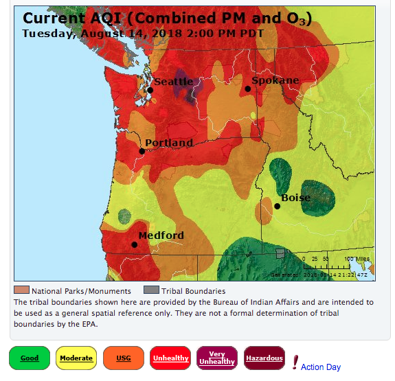
Fires across the region have blanketed the Northwest in smoke. Blazes in California and British Columbia are also adding to the thick, reddish-gray haze.  

The Space Needle’s panoramic webcam shows a thick layer of reddish-gray haze over Seattle and that doesn’t change much nearly 300 miles east in Spokane. Along the Interstate 5 corridor for 140 miles from Medford, Oregon, north to Portland, the skies are filled with smoke that burns your eyes and scratches your throat.

Air quality across the Northwest is mostly unhealthy due to fires in Washington, Oregon, Idaho, California and British Columbia. Screen grab from Washington Smoke Blog Aug. 14, 2018

Air quality across the Northwest is mostly unhealthy due to fires in Washington, Oregon, Idaho, California and British Columbia. Screen grab from Washington Smoke Blog Aug. 14, 2018

“We expect this to kind of stick around for the time being,” said Spokane meteorologist Bryce Williams.

And, Williams says, expect poor air quality for the foreseeable future.

RESOURCE: The Washington Smoke Blog lists air quality and smoke forecasts for the Northwest region

“Usually it would take a strong low-pressure system that brings a cold front that could scour out the smoke,” Williams said. “But the fly in the ointment would be the additional fact that we are basically surrounded by fires in all directions, so no matter which way the wind blows it may clear out what we have now, but it’s also going to be bringing in more behind it.”

The smoke has not affected aviation operations at regional airports in Spokane, Salem or Washington’s Tri-Cities. But outdoor recreation is taking a hit. Public pools in Spokane are closed until air quality falls below 150 on the air quality index. In Portland, the pools are open, but some outdoor activities hosted by the Parks and Recreation Department there have been moved inside.

Copyright 2018 Northwest News Network

Related Stories:

A map showing large fires that have burned so far this year in Washington. The different colored areas represent different land ownership boundaries. (Courtesy of the Northwest Interagency Coordination Center)

What impacts did wildfires have on the Northwest this summer?

Autumn has knocked on our doors and crossed our thresholds. With its arrival comes wetter, colder, darker days — perhaps some pumpkin-flavored treats as well — and hopefully, fewer wildfires. Heavy recent rainfall has dropped the wildfire potential outlook down to normal for the Northwest, according to the National Significant Wildland Fire Potential Outlook.
So, how did this summer fare compared to past fire seasons? Continue Reading What impacts did wildfires have on the Northwest this summer?

The Sourdough Fire has consumed 1,710 acres of forest since starting July 29. // CREDIT: Washington State Department of Transportation North on Twitter.

Part of HWY 20 reopened, firefighters still actively working in area as Sourdough Fire burns

Scenic State Route 20 which runs through North Cascades National Park is now reopened.
The highway had been closed between Newhalem and Rainy Pass in Whatcom County, as it is the main access point for firefighters working the Sourdough Fire. Mark Enty, public information officer with Northwest Incident Management Team 10, said crews are still working in the area and drivers should be extra cautious.
Continue Reading Part of HWY 20 reopened, firefighters still actively working in area as Sourdough Fire burns