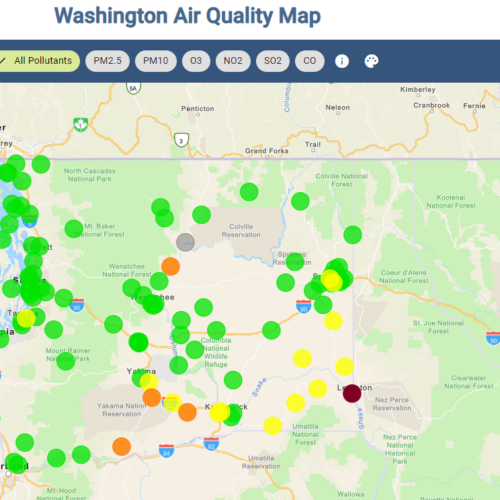
Emergency Managers In ‘Defense Mode’ As Okanogan Flood Outlook Changes To Lower Level

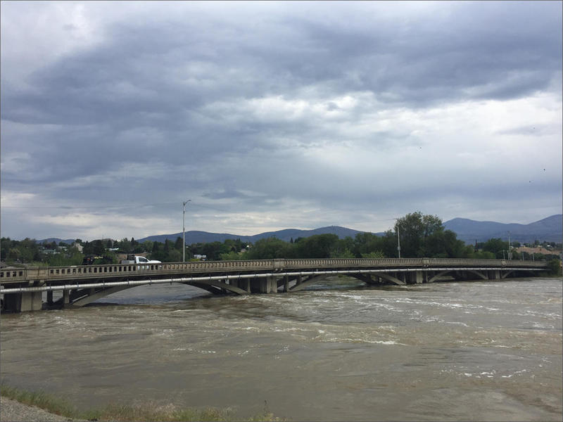
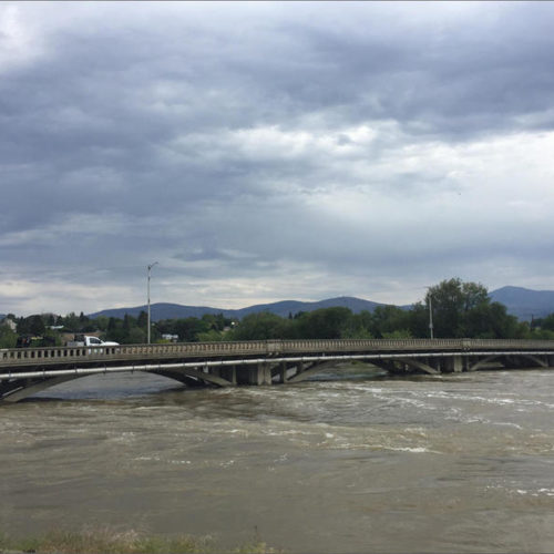
As Okanogan River Recedes, Memories Of Past Floods Remain
The Okanogan River has receded from its emergency flood stage seen for several weeks in May. Left behind are the memories and high-water marks of floods and natural disasters past.
Emergency Managers In ‘Defense Mode’ As Okanogan Flood Outlook Changes To Lower Level
A week ago, forecasters were predicting the Okanogan River might crest this weekend near a record flood mark set back in 1972. Now, emergency managers are moving into “defense mode” and are now predicting somewhat lower water levels.

Okanogan And Ferry County Flooding: Emergency Information And Updates
Conditions in Okanogan and Ferry counties have moved to a major flood state, where Governor Jay Inslee has declared an emergency. The Okanogan River is expected to continue rising through the weekend and through the following week to a level not reached since the historic flood of 1972.